Ofertas Topocomponentes

Novedades

Todas las novedades
  • Nuevo

Gps Centimétrico SOUTH INNO8 GNSS IMU Rover KIT

9.000,00 €

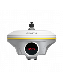
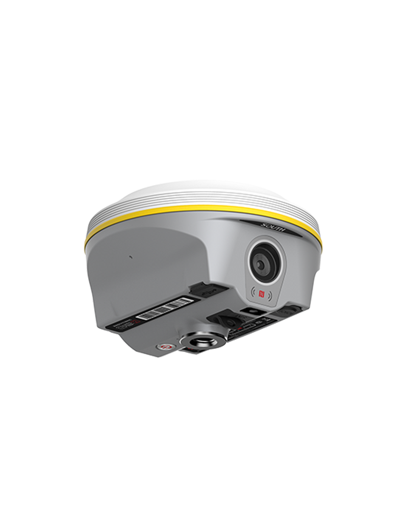
GNSS IMU Especial para Fotogrametria

Cantidad
Últimas unidades en stock

Posicionamiento visual y replanteo

Hasta 1760 canales

Modelado 3D

Farlink 2.0

3 formas de procesamiento

IMU de cuarta generación

----

More Points Collected in Less Time, With Less Blind Spots

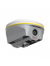
More Efficient than Traditional RTK

 √ SOUTH Group has accumulated a decade of experience in the development of UAV photogrammetry solutions. This has led to the creation of a unique and efficient photogrammetry algorithm for INNO8. This allows INNO8 to directly collect both image and coordinate data. Users can capture still photos or shoot videos while walking. With just one group of photos or a video, users can obtain coordinates for all target points within the measurable range, measuring hundreds of points in few minutes.

√ Compared to traditional photogrammetry equipment, INNO8’s data acquisition speed is faster. After collecting photos or videos, users can perform real-time automatic processing by using data collection App on controller. This allows users to obtain coordinates without the need for PC post-processing software, especially in time-sensitive situations.

√  Compared to traditional RTK, INNO8 has a broader working range and fewer blind spots. By photogrammetry function, surveyors can remotely measure points that are without GNSS signal or poor signal quality, from a well-signaled position. Points without satellite signals, such as spaces under rooftops, can now be measured. Previously challenging blind spots or places with severe multipath effects like dense tree areas or construction sites with multiple obstacles, are now easier to measure.

Easy to Learn, Effortless to Use, and Uncomplicated for Re-measurement

 More User-friendly than Traditional RTK

 √ When surveyors process photos in the controller App, they simply need to click on the same point in just three photos to calculate the coordinates. This operation is quite easy to learn.

√ A notable feature of photogrammetry is labor-saving. When using INNO8, surveyors can achieve remote measurements at distances of up to 10 meters or even more (in ideal condition), eliminating the need to physically approach each measurement point. This working method significantly saves the surveyor's physical effort, reducing the labor involved in fieldwork.

√ In cases some data needs to be remeasured, surveyors do not have to return to the field. They can simply click on the saved photos to obtain coordinates, making re-measurement a hassle-free process.

ESPECIFICACIONES:

GNSS

Performances

Signal Tracking(1598)

Signal Tracking(1698)

Signal Tracking(1760)

1598 channels

GPS: L1, L1C, L2C, L2P, L5 GLONASS: L1C/A,L1P,L2C/A,L2P,L3

BDS: BDS-2: B1I, B2I, B3I, BDS-3: B1I, B3I, B1C, B2a, B2b* GALILEO: E1, E5A, E5B, E6C, AltBOC* SBAS(WAAS/MSAS/EGNOS/GAGAN): L1*

IRNSS: L5* QZSS: L1, L2C, L5*

MSS L-Band: BDS-PPP, Galileo HAS

1698 channels

GPS: L1, L1C, L2C, L2P, L5 GLONASS: G1, G2, G3

BDS: B1I, B2I, B3L, B1C, B2A, B2B* GALILEO: E1, E5A, E5B, E6C*

SBAS(WAAS/MSAS/EGNOS/GAGAN): L1C, L1A*

Navic/IRNSS: L5* QZSS: L1, L2C, L5*

MSS L-Band: Reserve

1760 channels

GPS: L1C/A, L1C, L2C, L2P, L5 GLONASS: L1C/A, L2C/A, L2P, L3CDMA BDS: B1I, B1C, B2I, B2a, B3

GALILEO: E1, E5A, E5B, E5AltBOC, E6

SBAS: EGNOS, WAAS, GAGAN, MSAS, SDCM(L1,L5)

Navic: L5

QZSS: L1C/A, L1C, L2C, L5, L6

MSS L-Band: BDS-PPP, Galileo HAS*

Other Features

Initialization Time: <10s          Initialization reliability: >99.99% Positioning output rate: 1Hz~20Hz

Positioning Precision

Code differential GNSS positioning

Static(long observations)

Static

H: 0.25m+1 ppm RMS V: 0.50m+1 ppm RMS

H: 2.5mm+0.1 ppm RMS

V: 3mm+0.4 ppm RMS

H: 2.5 mm + 0.5 ppm RMS V: 3.5 mm + 0.5 ppm RMS

Rapid static

PPK

RTK(UHF)

H: 2.5 mm + 0.5 ppm RMS

V: 5 mm + 0.5 ppm RMS

H: 3 mm + 1 ppm RMS V: 5 mm + 1 ppm RMS

H: 8 mm + 1 ppm RMS V: 15 mm + 1 ppm RMS

RTK(NTRIP)

RTK initialization time

SBAS positioning

H: 8 mm + 0.5 ppm RMS V: 15 mm + 0.5 ppm RMS

2 ~ 8s

Typically<5m 3DRMS

BDSPPP

Galileo HAS


H:10cm V: 20cm

H: 20cm V: 40cm


IMU

Update Rate

Tilt Angle

Initialization Way

Type

200Hz

0-60°

Shake or Walk

Calibration Free

User Interface

Keys

Touch Screen

LED

WEB UI

Power Key

HD 1.39inches color circle touch screen

Power Indicator

Supported

Voice Guidence

Language Supported

Supported

Chinese, English, Korean, Russian, Spanish, Portuguese, Turkish, French, Italian

Operating system

Secondary development

Cloud service

Linux

Provides secondary development package and opens the OpenSIC observation data format and interaction interface definition

Cloud serviceThe powerful cloud platform provides online services like remote management, firmware update, online register, etc.

Hardware

Dimension

Weight

Material

Temperature

Humidity

Waterproof/Dustproof Shock/Vibration

155mm(Φ)

*98.5mm(H)

1.2kg

Magnesium aluminum alloy shell

Working: -45 to +75 Storage: -55 to +85

100% Non

-condensing

IP68 standard;

Withstand 2m pole drop onto the cement ground naturally

Power Supply

Battery

6-18V DC, overvoltage protection

Built-in 7.4V 10000mAh, PD quick charge protocol; rover data collector internet mode>20h

Electronic bubble

GPCE-INNO8
1 Artículo
2024-02-02

Descargas

Catalogo GNSS SouthINNO8 en

Catalogo GNSS SouthINNO8 en ingles

Descargas (2.34M)